National Parks in the North Burnett

Mount Walsh National Park
Rising to 703m above sea level, Mount Walsh National Park is a rugged park with spectacular exposed granite outcrops and cliffs. The “Bluff” area of Mount Walsh at the park’s northern end is a prominent landmark in the Biggenden area.
Most of this rugged park is suitable only for experienced, well equipped bushwalkers with sound bush skills. A 300m trail leads from the picnic area through open forest to a rocky creek gully fringed with dry rainforest. Continue 200m to the treeline for views over the surrounding countryside. Only experienced walkers should attempt the 2.5 hour hike to the summit of Mt Walsh.
Taking a walk with an accredited Bush Walking Guide is a great way for bush walkers of any experience to enjoy the National Park. Moira from Experience Altitude has over 30 years of exploring experience in Mt Walsh National Park. Moira says that “guided walks give you a chance to learn about the environment, ecosystems, walking and climbing techniques as well as local historical and Indigenous facts.”
For those less adventurous but still want to get a great view of Mt Walsh, the view near the Biggenden Airstrip is easily accessible for everyone – no mountain climbing required!
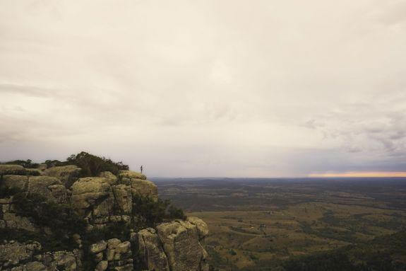
The Summit, Mt Walsh National Park. Photo Credit: Gareth McGuigan
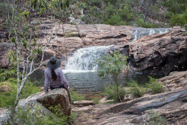
“Utopia” – the Waterfall Creek Rockpools in the Mt Walsh National Park
Woowoonga National Park
Picnic or barbecue beside a rocky creek adjacent to the National Park. On a clear day spectacular views of Binjour Plateau, Burnett Ranges, Fraser Island and Biggenden township are possible.
Bushwalking can be enjoyed at Mt Woowoonga but it is a challenging landscape and is only recommended for the fit and experienced hiker. The trail to the lookout is an average gradient of 100 but the gradient increases to 300 to 400 on the section from the lookout to the summit. Take a compass and follow the red markers. Start your walk near the picnic area. Wear a hat and sunscreen. Take water and stay on the trail. Allow 3hours for the return trip to the summit.
For walking track information, map and park alerts please check: https://parks.des.qld.gov.au/parks/woowoonga/
Facilities: A Council picnic shelter, tank water and a wood barbecue are provided. There are no toilets.
Bush camping is prohibited. Accommodation is available in nearby Biggenden.
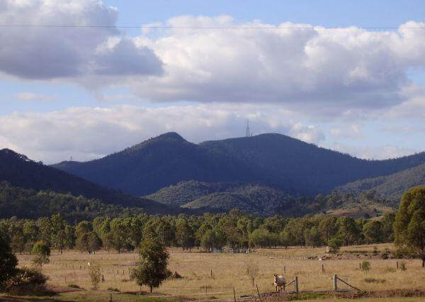
Woowoonga National Park
Coalstoun Lakes National Park
Turn off the Isis Highway 20km south of Biggenden or 4km north of Coalstoun Lakes into Crater Lakes Road. Follow the gravel track to the base of the northern crater. Rising 200m above a broad cultivated valley, Mt Le Brun contains two large craters which occasionally fill with shallow lakes.
The lakes were named after Coalstoun in Scotland by Wade Brun, manager of nearby Ban Ban Station. The crater lakes are protected in Coalstoun Lakes National Park.
This is a park for birdwatching and nature study.
Walking: Leave your car at the base of the mountain where the crater trail begins and walk up the steep outer side of the northern crater for a great view over the vine forest and crater. Continue down into the crater. Allow 30 minutes to traverse the trail which is approximately 1km return. As you head up the northern crater you will see the patch of brigalow scrub next to the park. Wear a hat, sunscreen and protective clothing to avoid being scratched by prickly shrubs in the vine thicket.
For walking track information, map and park alerts please check: https://parks.des.qld.gov.au/parks/coalstoun-lakes/
Facilities: There are no facilities in this park and camping is prohibited.
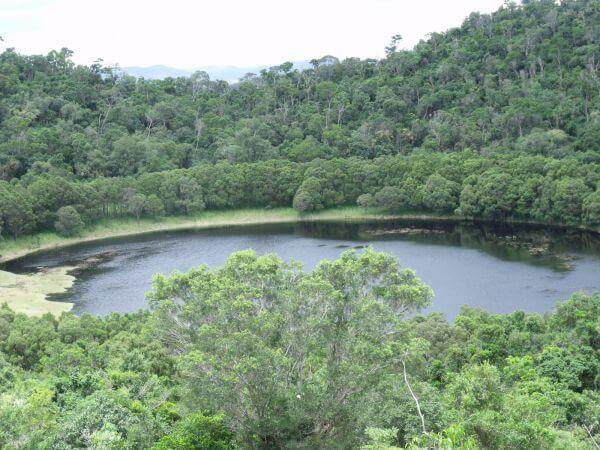
Coalstoun Lakes National Park, volcanic crater
Share your adventures with us on Facebook and Instagram! #visitnorthburnett
Cania Gorge National Park
Discover the natural wonder of one of Queensland’s best kept secrets! Sheer towering cliffs, countless rock formations, hidden caves and the beautiful Castle Mountain – best viewed in the late afternoon sun!
Cania Gorge National Park is the closest park to the coast in which you can see the sandstone landscapes of central Queensland.
Visitors enjoy an amazing variety of scenery, wildlife and history along the many walking tracks available.
Indigenous people have lived in Cania Gorge for thousands of years and the freehand art on remote sandstone walls is a reminder of their special way of life.
The Cania Gorge National Park is world renowned for its beauty. With the stunning sandstone landscapes, extensive bushwalking tracks, aboriginal art and secluded pockets of stunning rainforest, it is little wonder people come from all over Australia to visit this area.
Park Features
There are more than 150 different types of plan communities found in the Cania Gorge region. This includes briaglow forest, eucalypt woodland, cypress pine woodland, dry rainforest and grassland.
The birdlife is abundant – being home to more than 90 birds species!
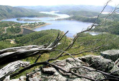
The view from Castle Mountain, Cania Gorge National Park.
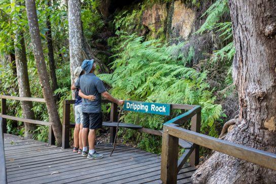
“Dripping Rock” – Cania Gorge National Park
Culture and history
Cania Gorge was carved out of sandstone by the slow movement of water.
Indigenous people have lived in Cania Gorge for at least 19,000 years. They used the gorges as they offered access to predictable water and food resources. Archaeologists are continuing their research on Aboriginal occupation of the gorge over time. Within caves teeth, bone and stone tools have been recovered.
There are nine recorded Aboriginal art sites in Cania Gorge, but these are not all accessible to the public. Paintings include handprints and images of animals and their tracks. The art style in Cania Gorge is freehand painting – very different to other parks found in the west and south-west, and serves as a reminder of their special way of life.
Thomas Archer was the first European to explore the headwaters of the Burnett River.
During the 1850s Cania Station was established and ran sheep until 1883 when beef and dairy cattle were introduced. In 1870 gold was discovered to the north of Cania Gorge and quickly the township ‘Cania Goldfields’ appeared along the Three Moon Creek. Mining ended in the early 1920’s and the population declined. Lake Cania now covers the remains of the goldfields.
Cania Gorge National Park was gazetted in 1977, with futher additions made in 1979, and in 1989 the Francis fmaily, owners of Cania Station, donated the land that comprises the central section of the park.
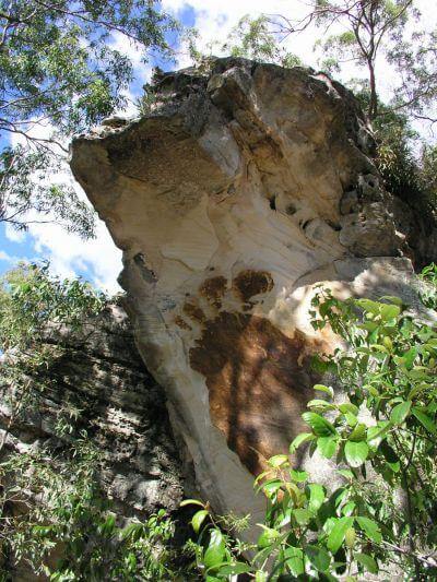
“Big Foot” Aboriginal Art at Cania Gorge
Wildlife
Afternoons are the best time to see some of Cania Gorge’s wildlife. Be sure to bring your camera and binoculars you’ll never know what you might find!
Look up at the cliffs where a peregrine falcon or wedge-tailed eagle may be soaring. You might also hear the joyful calls of sulphur-crested cockatoos, currawongs, king parrots, dollarbirds, wompoo pigeons or regent bowerbirds. Lace monitors might be disguised among the trees.
On the forest floor, rainbow skinks, wood geckos or eastern pebble-mound mice might be seen. Whiptail wallabies, black-striped wallabies and Herbert’s rock-wallabies live around the Gorges and Park.
Australian brush-turkeys often rustle through the undergrowth, building nesting mounds on the forest floor for egg incubation.
Sheathtail bats often hide in the sandstone cracks, crevies and caves during the day.
Platypus live in the waterholes below the dam wall
After rain or in the wet areas like Dripping Rock or The Overhang, listen for choruses of frogs.
At night, different animals appear. Yellow-bellied gliders take cover in hollow trees during the day and at night can glide up to 100 metres! They make distinctive cuts in the bark of eucalypts.
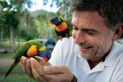
Wildlife at Cania Gorge National Park. Photo Credit: Tourism and Events Queensland.
Getting here
Cania Gorge is about 225km west of Bundaberg or about 500km north-west of Brisbane.
Once you reach Monto, travel 12km north on the A3 Burnett Highway. Branch off onto the sealed Cania Road for 14km passing through the small settlement of Moonford to the main picnic area.
Facilities
Picnic shelters, barbecues, interpretive display, public toilets and car parking available at the Cania Gorge Picnic Area.
Accessibility
Wheelchair-accessible toilets and picnic tables are available at the Three Moon Creek picnic area. You will have to cross grassy areas to reach the covered picnic tables and barbecues. The shelters are paved sandstone.
Camping at Cania Gorge National Park
Camping is not permitted in Cania Gorge National Park.
Caravan and camping parks and other accomodation are provided nearby to the Park and in Monto.
Walking Tracks
Within the 3000 hectare park there are a variety of walking tracks ranging in length from 300m to 22km.
View weird and wonderful rock shapes – Elephant’s Head, Dripping Rock, Big Foot, The Overhang and Dragon Cave with Jacob’s Skull.
Ensure you carry plenty of drinking water for each walk and be cautious on loose gravel surfaces.
Use the walking track grades to choose the most suitable walks for your fitness and bushwalking experience. Allow more time to include rests if you are an inexperienced bushwalker or walking with young children.
For a map on the walking trails, view: https://parks.des.qld.gov.au/parks/cania-gorge/pdf/cania-gorge-np-map.pdf
For walking track information, maps and park alerts please check: https://parks.des.qld.gov.au/parks/cania-gorge/
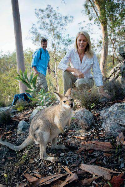
Cania Gorge National Park. Photo credit: Tourism and Events Queensland
Share your adventures with us on Facebook and Instagram! #visitnorthburnett
Auburn River National Park
Auburn River National Park is a short 40km drive southwest of Mundubbera.
The Auburn River flows through this National Park over huge salmon coloured boulders through a steep-sided gorge.
The park protects a western hardwood forest, now uncommon in the area, and provides habitat for many plants and animals.
Peregrine falcons nest in the cliffs and brush tailed rock wallabies and red necked wallabies inhabit the scrubby gullies near the camping area. The forest and waterholes are also good spots for bird watching so don’t forget your binoculars.
In the spring the wildflowers are in full bloom and the river is teeming with interesting aquatic wildlife.
The Riverbed and Rockpools are an exciting part of the National Park to explore. Take care when walking on wet rock surfaces, as they can be slippery. Supervise children closely. For those adventurous, explore the Riverbed and Rockpools and see if you can find the ‘dinosaur eggs’. Locals have nicknamed the large granite boulders ‘dinosaur eggs’ due to their smooth and rounded appearance after being carved by water over a long period of time.
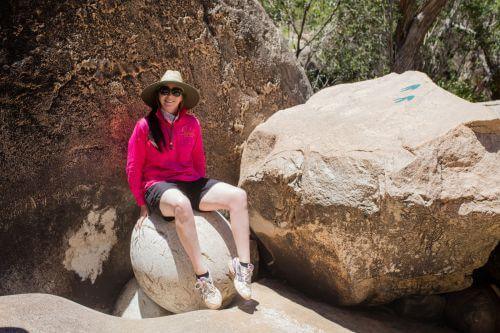
The ‘dinosaur eggs’ at Auburn River National Park
Getting here
Travel 13km south along the Mundubbera/Durong Road. Turn onto Hawkwood Road after crossing the Boyne River. Travel for about 20km until you reach the Auburn River National Park turn-off. From the turn-off, drive a further 7km to the park along a rough unsealed road. Four-wheel-drive is recommended in wet weather. Stay on the road, as soils are treacherous when wet.
Walking: There are no graded walking tracks in Auburn River National Park, only rough footpads. Walks begin from the picnic and camping area. If you intend to bushwalk away from the trails, obtain a topographic map from the Queensland Parks and Wildlife Service office in Mundubbera and ask for advice before setting off.
Facilities
A basic camping area, picnic tables, electric barbecue and toilet facilities are provided on the northern bank of the Auburn River in a picturesque bush setting.
Camping
Camping permits are required and fees apply.
To make a booking see: https://parks.des.qld.gov.au/experiences/camping/camping_bookings.html
Please note that phone and internet coverage is unreliable in the park, please make bookings prior to arrival at the park.
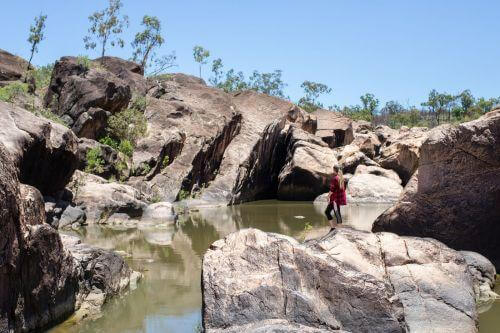
Riverbed and Rockpools at Auburn River National Park
Walking Tracks
There are several walking tracks starting from the picnic/camping area ranging from 600m to over 3km with different degrees of difficulty.
Gorge Lookout Walk
Distance: 600m return. Allow 15mins.
The short track leaves from the end of the car park and continues to impressive views across the Auburn River gorge. Views of the river and its distinctive boulders are ready to be captured on camera. The ‘Giant’s Chair’ can be seen from the lookout; so too is a peregrine falcon’s nest—easily detected because of the telltale signs of ‘white-wash’ marks on the cliff face below a collection of sticks and debris which make up the nest. Unfenced lookout: Stay well back from the edge and supervise children at all times.
Riverbed and Rock Pools Walk Distance
Distance: 1.5km return. Allow 1hr.
Auburn River National Park – Gorge Lookout
This is a strenuous walk and should only be attempted by fit walkers. This rough track winds down the side of the gorge to the river, travelling through dry rainforest, eucalypt forest and creek vegetation. The swollen trunks of bottle trees are a forest feature.
Before exploring the river: take time to observe the immediate area to ensure you will be able to find the trail on your return.
Gorge Top Walk Distance
Distance: 3.2km return. Allow 1hr 30mins.
The track follows the river on a gentle walk through open eucalypt forest along the top of the gorge. At the lookout there are spectacular views down the river, which flows over a series of cascades to the Auburn River Falls—best viewed after heavy rain.
For walking track information, maps and park alerts please check: Auburn River National Park
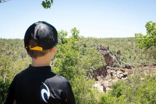
Auburn River National Park – Gorge Lookout
Share your adventures with us on Facebook and Instagram! #visitnorthburnett
